What the heck. https://uploads.disquscdn.c...
Climatology
(Repeating my comment from below)
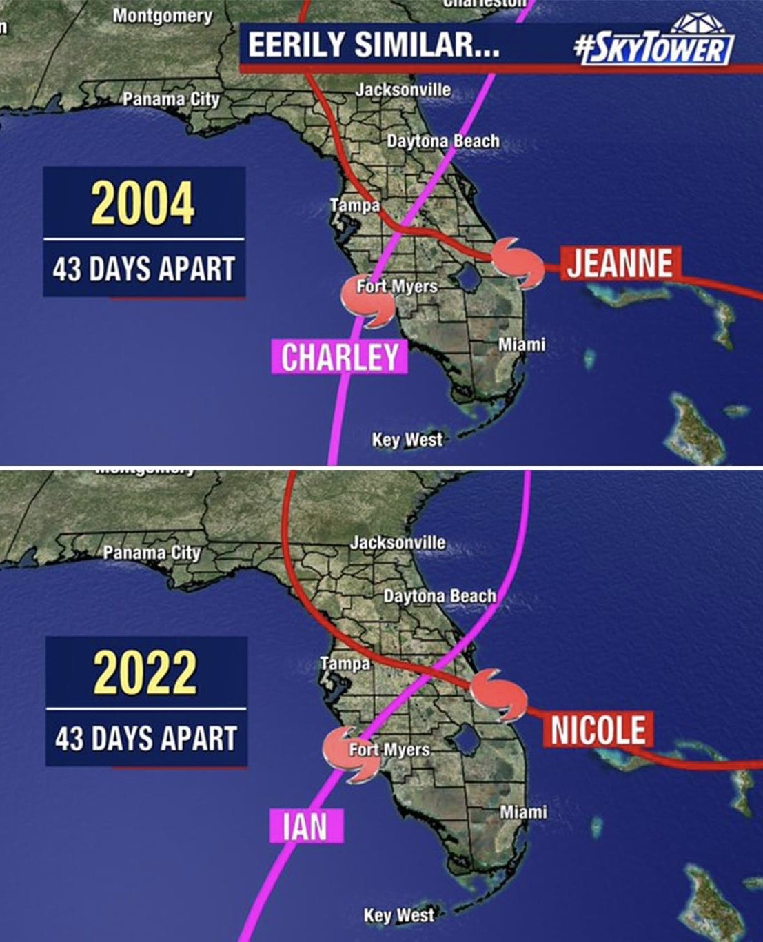
And the year after 2004 was 200… oh… never mind. 2013 came after 2004, right? Right? If we say it enough times it becomes true, right? And then we won’t see this pic repeated next year…
New post:
https://yaleclimateconnecti...
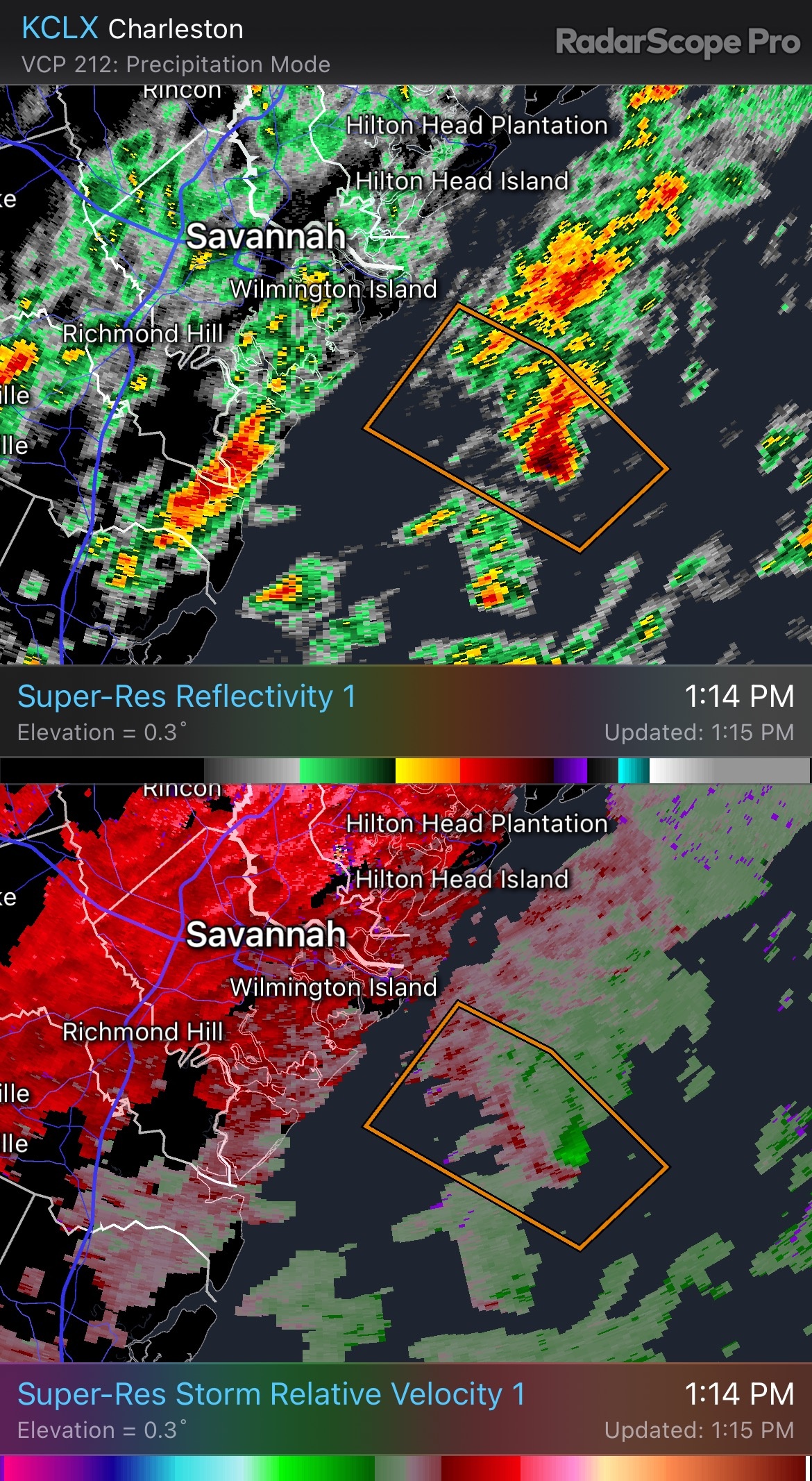
Keeping an eye on this marine-warned bean cell that has decent rotation. Generally headed my way.
Hubby and I have a joke turned into family terminology, beware of the cells with a red chewy center. That cell looks down right scary, past chewyness.
It started here:
https://uploads.disquscdn.c...
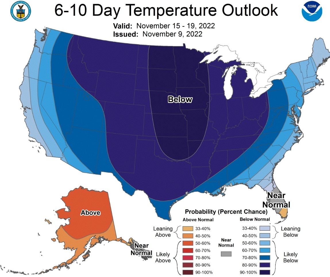
Last week we had a divided country with the west being cooler. Next week we are all united (a rarity, BTW)
https://twitter.com/Climato...
It's gotten even worse for the center of the country, but better for south Florida, the only spot in the Lower 48 that will be at or above normal in the 6-10 day range.
I'll take it.
https://uploads.disquscdn.c...
Europe will enjoy some fuel-saving warmth, though:
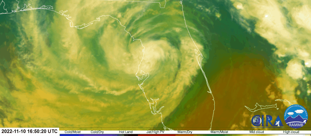
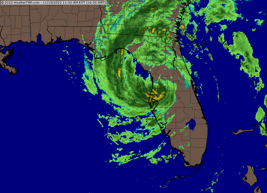
Looks like it has started to move NE. https://uploads.disquscdn.c...
That’s just an optical illusion as the cdo wanes in convection.
yeah not going to reach the gulf, never mind the panhandle
I’m probably 60+miles south and still feel effects. It’s far reaching
no doubt, large storm
Sat movement is very misleading. Don’t expect much deviation from this: https://uploads.disquscdn.c...
extreme east panhandle but not ramp up over gulf
panhandle will have mainly off shore winds
that's what it looks like on satellite anyway
Huh?
Convection warming rapidly.
Will the "eye" (OK, center of circulation) spend any time on the open GoM?
According to the NHC, yes. But they also said they don’t expect any strengthening, just continued weakening.
Florida must be somewhat "brown ocean" at this point, though. (Ah, well, it is November.)
Not in our region. It’s been dry for months.
Two deaths confirmed in Orlando
Wikipedia article on Nicole says 6 people confirmed dead in the Dominican Republic. The 2 in Orlando (electrocution?) make it 8 so far.
The 2 Orlando deaths bring the conus total for 2022 up to 155.
2022 is the deadliest season for the conus since 2017 (200 killed).
Deaths from live wires if the power is still up, or from home generator carbon monoxide if the power is out for a while.
For folks inland, it seems the most dangerous time is always just after the storm has passed.
Perfect ts here in Palm Harbor. No damage and very beneficial November rains.
Took these yesterday afternoon. Treated to a sundog in 1st pic and cloud shadows of a jet contrail in 2nd:
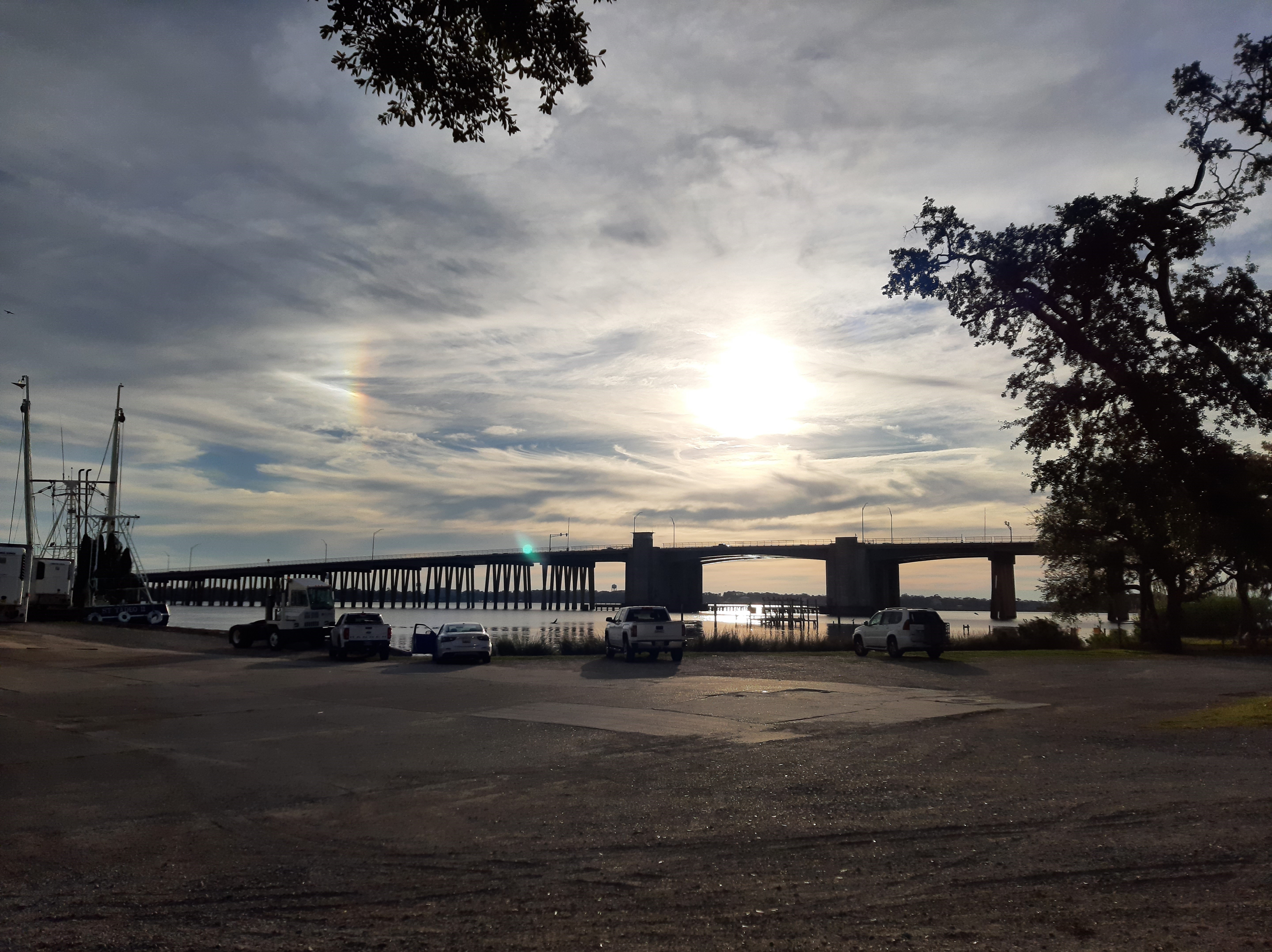
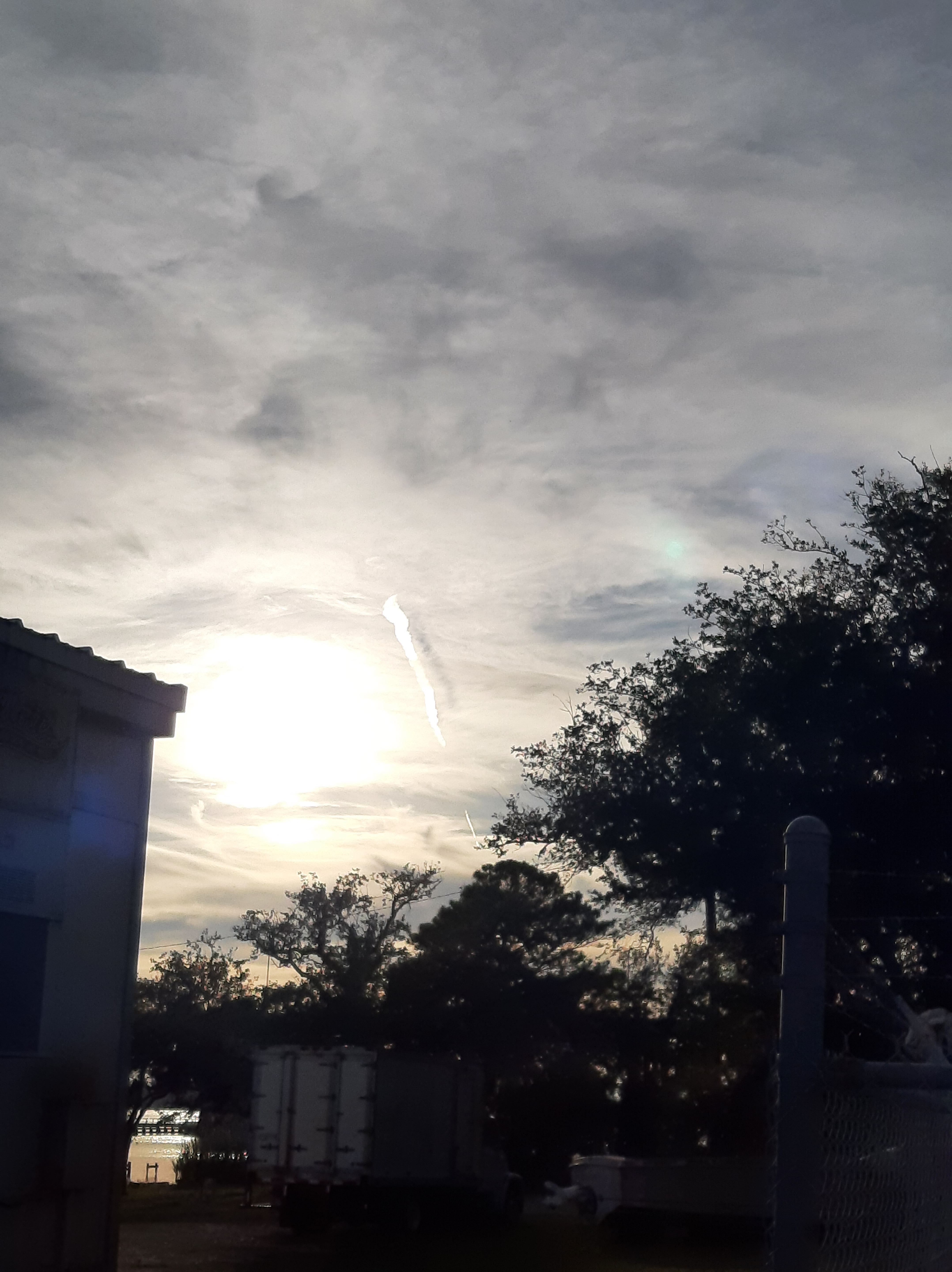
Very cool! Thanks.
Everyone Stay Safe from Nicole today and best wishes to those who were severely impacted by Nicole already in Florida including condolences as to any direct or indirect deaths from the storm. Will check on from the I-Phone later in day if I can.
[Side whine: The HAIL icon should not be prominent if there is "No Hail Expected". Don't tell people what not to worry about if it clutters the message.]
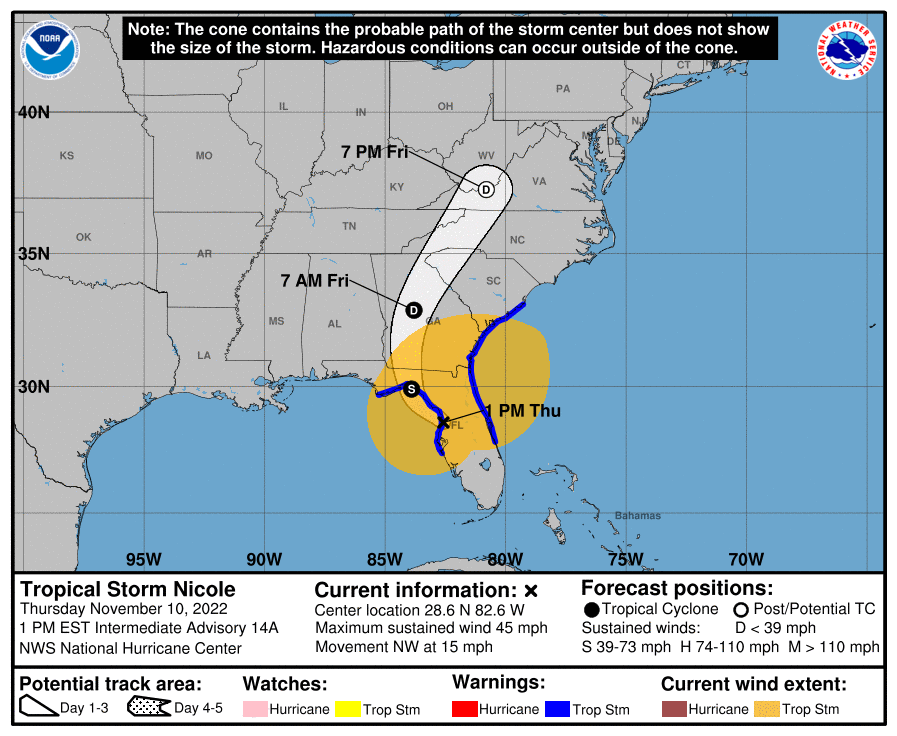
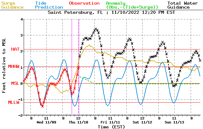
Can anyone help me predict what time the peak storm surge will happen in Tampa Bay? Originally, they were saying 1-3 feet of surge, prepare for inundation greater than 1 foot above ground. Now they are saying inundation around 3 feet. (I know this was always in the realm of possibilities but it does make a huge difference for folks in low lying areas around the bay like Shore Acres). I'm just watching the wind shift and wondering if anyone has thoughts on what time that 3 feet surge _might_ happen. High tide at 4:30pm is only 1.56 so it would flood the streets but not houses at that time. But at 1:40am the high tide is 2.7 so a 3 ft surge would put water in houses. Guess I'm just saying timing is going to make a huge difference here in terms of impact.
Around now to a little after midnight should be the worst. This is for St Pete. https://uploads.disquscdn.c...
Is it possible to change the numbers to "above MLLW" not MSL?
This is great! Where did you get this graphic???
Yes you can change to MLLW, It's here https://www.nws.noaa.gov/md...
My gut says it'd be associated with high tide which is at 5pm for the Tampa area. Don't know for sure though.
SLS was left out on purpose.
https://www.space.com/nasa-...
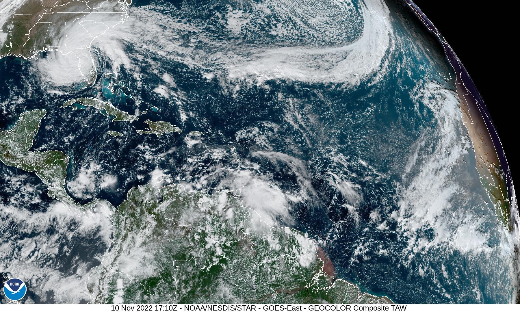
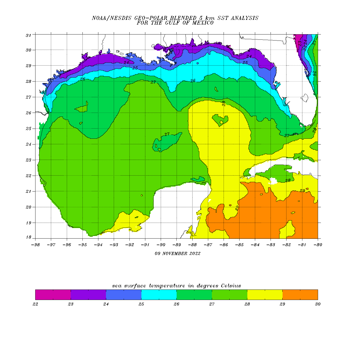
Wide shot; the trof merger presentation is impressive like with some past storms we have seen; glad the core will not be over water too long and that those NE FL Gulf shelf waters are pretty cool at this time:
The infusion of the cool air from the backside is helping with this impressive presence as well (barotropics)
As I stated last night, the decision to leave the SLS out in the storm was monetary.
https://arstechnica.com/sci...
The decision to remain at the pad came earlier this week with NASA on Tuesday saying, “Forecasts predict the greatest risks at the pad are high winds that are not expected to exceed the SLS design. The rocket is designed to withstand heavy rains at the launch pad and the spacecraft hatches have been secured to prevent water intrusion.”
Ahead of Nicole’s arrival, teams powered down Orion, the SLS core stage, interim cryogenic propulsion stage and boosters. A hard cover was also installed over the launch abort system window among other safety measures.
“Teams are poised to resume work as soon as weather and Kennedy center status allows,” NASA stated on Tuesday. “Once back on-site, technicians will perform walkdowns and inspections at the pad to assess the status of the rocket and spacecraft as soon as practicable.”Image 1 of 118
NASA had been planning a Monday, Nov. 14 launch right after midnight, but now aims for a two-hour window that opens at 1:04 a.m. Wednesday, Nov. 16, but also could shoot for a backup two-hour launch window on Saturday, Nov. 19 that opens at 1:45 a.m. If it launches that Wednesday,
the Orion capsule would return for a splashdown in the Pacific Ocean on Dec.
https://www.orlandosentinel...
Hopefully they'll light the candle Wednesday.
So why did NASA not just roll back for cover? The timing here is key. It takes about three days to prepare and roll the rocket back from the launch pad to the protective Vehicle Assembly Building at Kennedy Space Center. NASA, therefore, probably would have had to make the rollback decision Sunday. At the time, the most likely outcome, predicted by forecasters, was that the rocket would have been exposed to 40-knot winds.
Space agency officials have not been made publicly available to talk about their decision-making process, but NASA's blog post on Tuesday suggests that a final call was indeed made on Sunday night: "Based on expected weather conditions and options to roll back ahead of the storm, the agency determined Sunday evening the safest option for the launch hardware was to keep the Space Launch System rocket and Orion spacecraft secured at the pad."
From the space agency's vantage point on Sunday, there was clearly a non-zero risk of damaging winds to the rocket, but it was low, probably less than 5 percent. Rolling the rocket back at the time would have taken away several launch attempts, and perhaps even wiped out the entire November launch period, for the long-awaited Artemis I mission. If the launch was delayed into December, that would have opened up a host of other problems for the agency, perhaps most critically that its certification of the solid rocket booster lifetime—these massive powder-based boosters have been stacked for nearly two years—was about to expire.
nasa didnt believe the icon turning into a reliable model
Washington over Oregon ducks